

At a glance
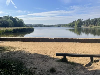
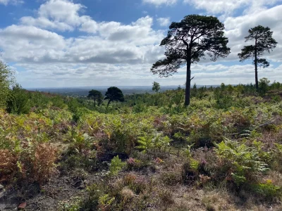
A great loop around Puttenham Common with terrain that’s largely suitable for Winter. With the varied scenery of some picturesque ponds and stunning viewpoints, this is a short walk that has a bit of everything.
Stay in the loop
Want to find more routes like this? Join the Surrey Walks mailing list to receive the latest routes, snippets of Surrey history and useful articles about the countryside.
Jump to:
- Route map & overview
- Setting off & viewpoint
- Second half & North Downs Way
- Parking & travel information
- Join the Facebook Group
- Review & final scores
Route map & overview
| Difficulty | Easy |
| Length | 5.4 km / 3.4 miles |
| Time taken | 1 hour 3 minutes |
| Elevation | One manageable climb |
| Dog Friendly? | Yes, but a bit of walking on a quiet access road and two road crossings |
Download the route file below to import it to your preferred app (a step by step guide can be found here).
Setting off & viewpoint
This route starts off at the Puttenham Commom Middle Car Park, just a few steps from the woods. Despite some recent rain, the terrain was largely solid and dry, a feature than continued throughout the bulk of the loop.

After a pleasant stroll you’ll soon find yourself at General’s Pond. There’s a muddy spot right before you reach the pond, but some well placed boardwalks prevent it from being an issue.

The pond is the first of a few bodies of water you’ll see on this route, which certainly helps vary the scenery. I can imagine on a Summer’s day with more leaves on the trees, the reflections from these ponds will be phenomenal.

From this point, you’ll soon encounter the only real gradient of this route. While not incredibly steep, it does seem to go on for a while, but you’ll certainly be rewarded for your efforts.

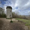
By following the path, you’ll reach the fort at Hillbury. Relative to many other hills in the Surrey AONB, this one isn’t particularly high up, but the views are great.

Second half & North Downs Way
After Hillbury, you’ll come to a point when the route turns onto the North Downs Way. Terrain wise, this is still a winter-proof stretch, but does have some uneven ground to watch out for.
Through the trees on your left you might see some nice sweeping views of the surrounding fields. Sadly, the path never quite gets close enough to be able to appreciate them. However, it’s easy to go a bit cross country and grab a nice photo.

The North Downs Way stretch doesn’t last too long though, and soon enough you’ll turn off, heading back into Puttenham Common.
For this next stretch, you generally stay in a straight line, again on great terrain. After passing the red brick Murtmoor mansion on your left, you continue for a while until you emerge from the woodland. You should soon see the Puttenham Common Top Car Park. This car park hosts some impressive views and a few picnic benches, making it the perfect place to pause.

This is probably the last main viewpoint of the route, but there’s still some great scenery ahead. After leaving the car park and crossing the road, you’ll soon turn onto a beautiful sunken path. These sort of paths are usually extremely muddy, but this one was solid and dry.

For the final stretch of the route, you’ll walk through the beautiful cottages of Rodsall Manor and Cutt Mill. Some of this walking is on a vehicle access road, but you’re unlikely to come across any cars.

Finally, just before crossing the road to head back to the car park, you’ll have some nice views over both Cutmill Pond and The Tarn. There are a couple of boardwalks that take you right to the edge of The Tarn, but you’ll be lucky if they’re not already being used for fishing.

From there, it’s a very short stretch back to the car, completing a relatively easy and short route that doesn’t compromise on great terrain and varied scenery.
Getting started
This route starts at Puttenham Common Middle Car Park. It’s pretty easy to access and generally big enough to not have to worry about finding a space. Even after finishing the route, it was probably less than half full. You do have the option to join the route at the slightly bigger top car park, which you can always keep as a backup plan.
Spread the word
The purpose of Surrey Walks is all about getting more people outside and enjoying the natural beauty of Surrey.
If you enjoy walking, please consider sharing this route, or this website, with a friend or family member who perhaps doesn’t walk as much. It’s well documented that walking is great for our health and our happiness, so the more people that can experience those benefits, the better. Alternatively, click below to join the growing Surrey Walks Community on Facebook.